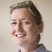
Keynote Lecture at the 8th Workshop on EO in the Global South:
Making poverty visible – The successes and failures of remote sensing and other geodata

Hannes Taubenböck – German Aerospace Center (DLR) and University of Würzburg
“Because some are in the dark. And others are in the light. And you see those in the light. You don’t see the ones in the dark.” is a quote from the Mackie Messer’s Moritat from the 1928 play ‘The Threepenny Opera’ by Bertolt Brecht. This quote was just as relevant back then as it is today. Today, however, remote sensing is a data source that helps to bring more light into the darkness. Through the proxy of settlement structures of slums or comparable structures or through night-time light data the gigantic dimension of poverty becomes not only visible in remote sensing data, but also quantifiable. This keynote will show how much light remote sensing in combination with other geodata has shed on the global issue of poverty, where knowledge gaps still exist, what limitations prevent the necessary knowledge gain and where science needs to break new ground
More information about Hannes’ research here.
Keynote Lecture at the 3rd Workshop on Forestry:
Advancing Remote Sensing Techniques for Comprehensive Forest Monitoring: Bridging Policy Needs and Technical Challenges

Annemarie Bastrup-Birk – University of Copenhagen
Remote sensing techniques have become increasingly crucial for implementing and monitoring forest-related policies at European and global levels. This abstract presents an overview of key policies that rely on Earth Observation (EO) data, focusing on the technical aspects of deriving essential forest indicators. The EU Forest Strategy, LULUCF regulation, and global initiatives like REDD+ require accurate quantification of forest extent, biomass, carbon stocks, and disturbances. Satellite-based approaches using optical and radar sensors enable large-scale mapping of forest cover and changes. However, deriving structural metrics like aboveground biomass remains challenging, necessitating the integration of spaceborne LiDAR (e.g., GEDI) with other data sources. Critical indicators include forest area, growing stock volume, biomass, carbon sequestration, and disturbance rates. While coarse resolution products are available globally, policy implementation often requires higher spatial and temporal resolutions. Opportunities exist in fusing multi-sensor data and leveraging time series to improve accuracy. Challenges persist in accounting for diverse forest types, ensuring consistency across scales, and quantifying uncertainties. Advances in machine learning show promise for indicator estimation, but further research is needed on transferability and robustness. This abstract will discuss state-of-the-art methods, accuracy requirements, and future directions for EO-based forest monitoring to support evidence-based policymaking.
Link to the Dr. Bastrup-Birk’s university website.
Keynote Lecture:
Advancing Remote Sensing with Deep Learning: Challenges, Innovations, and Future Directions

Lukáš Brodský – Charles University in Prague
Remote sensing has undergone a transformative evolution since the 1970s, when Landsat systems pioneered Earth observation. Initially dominated by visual interpretation and rule-based computer programs, the field has now embraced AI-driven automation, leveraging deep learning and advanced computational frameworks. Today’s remote sensing ecosystem integrates multi-sensor fusion, high-resolution imagery, and near real-time analytics, harnessing the power of big data. Deep learning, particularly convolutional neural networks (CNNs), vision transformers (ViTs), and self-supervised learning, has revolutionized feature extraction, scalability, and inference efficiency. Multimodal learning further enhances insights by integrating optical, radar, LiDAR, and hyperspectral data, mitigating the limitations of single-sensor approaches. Alongside AI-driven advances, physical modeling techniques such as Radiative Transfer Modeling (RTM) remain fundamental for accurate retrieval of geophysical parameters, bridging the gap between empirical data-driven approaches and physically consistent interpretations. The synergy between deep learning and physical modeling holds great potential for improving model generalization, reducing data dependency, and enhancing uncertainty quantification in remote sensing applications. This talk will explore the convergence of deep learning, physical modeling, and remote sensing, addressing challenges such as model generalization, data sparsity, computational constraints, and interpretability. Ultimately, the key question remains: Is deep learning the transformative breakthrough that will define the future of remote sensing, or just an intermediate step toward even more advanced technological innovations?
Keynote Lecture at the 3rd Workshop on Agriculture:
Challenges and recommendations for leveraging remote sensing for food security

Filippo Sarvia – Food and Agriculture Organization of the United Nations
The global population is expected to reach 9.8 billion by 2050, necessitating a significant increase in food production to meet growing demands. However, limited land and water resources, climate change, and the increasing frequency of extreme weather events threaten agricultural production each year. Remote sensing is a powerful technique that supports food security by enabling large-scale, high-frequency agricultural monitoring. In alignment with the Food and Agriculture Organization’s (FAO) mandate and Sustainable Development Goals (SDGs), particularly SDG 2—Zero Hunger, remote sensing contributes to land cover and land use classification, crop mapping, yield estimation, drought assessment, and early warning systems for agricultural risk management. However, several challenges hinder its full potential, including data accessibility restrictions, high processing costs and time requirements, inconsistencies in spatial and temporal resolutions, atmospheric interferences (e.g., cloud cover), and the need for extensive ground-truthing to improve classification accuracy during training and validation phases. Addressing these challenges requires coordinated efforts, research and capacity development in low and middle income countries, where agricultural monitoring is more critical and yet complicated by limited financial and technical capacities. Strengthening collaborations between research institutions, policymakers, and international organizations will be important to optimizing remote sensing applications for global food security monitoring and policy support.
